All Maps are Wrong
Tasks
|
||||||
MathsHave you ever tried gift wrapping a football? Then you may have noticed that fitting a flat piece of paper around a sphere will always result in some distortion. Traditional maps usually stretch the North Pole to fit along the entire top of the map. That means countries closer to the Poles appear bigger on the map than in real life. On a traditional map, a straight line represents travelling in a constant compass direction, such as due East. This is useful for sailors and pilots.
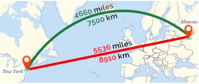
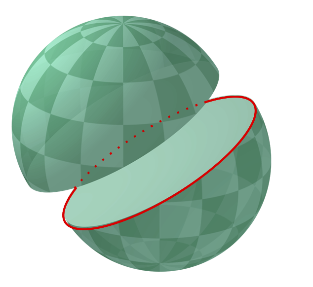
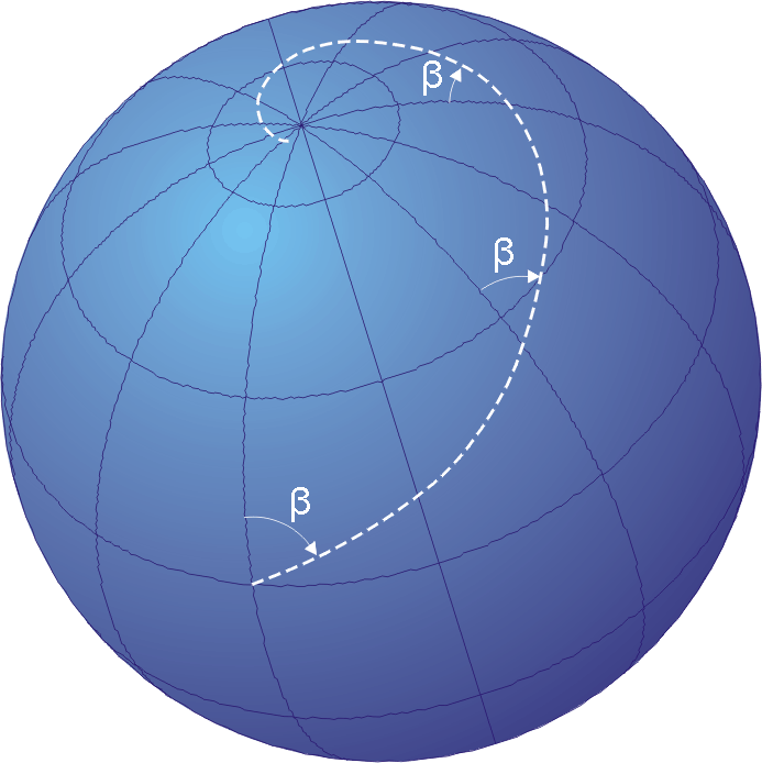
A great circle is the largest circle that can be drawn on a sphere. There are many great circles on a sphere, and all great circles slice the sphere through the centre into two equal hemispheres.
The shortest distance on a globe is always part of a great circle. This path appears as a curve on a traditional map. A globe will always preserve shape, distance, and direction, but a map cannot preserve all these properties at the same time. |
||||||
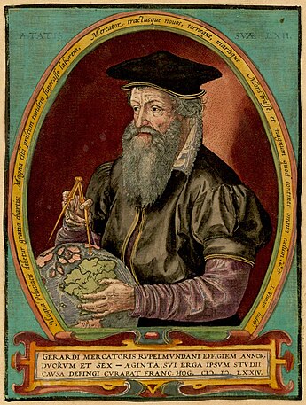
HistoryEarly navigators could establish a ship’s latitude (the distance north or south of the equator) using the sun and the stars. But there was no accurate way to determine longitude (the distance east or west of the Greenwich meridian line). So, to navigate, a ship would have to sail to the correct latitude first, and then sail in a constant direction east or west until they reached their destination. In 1579, Flemish mapmaker Geradus Mercator published a new kind a map for sailors where travel along a constant compass bearing, such as North-East, would appear as a straight line on the map. This map was based on work by Portuguese mathematician Pedro Nunes. Mercator’s map is very useful for sailors and pilots, but it significantly stetches areas far north or south of the equator. Other maps were devised that preserve all areas, but they do not preserve compass direction as straight lines. In 1827, German mathematician Carl Friedrich Gauss proved that the surface of sphere cannot be unfolded into a flat surface without distorting some distances. This proves that all maps are a little bit wrong. |
||||||
People
|
||||||
ApplicationsIn navigation, the traditional Mercator map is useful because any course along a constant compass bearing, such as North-East, will appear as a straight line. Using a Mercator map, a sailor or pilot, can simply plot their start and end points, note the direction they need to travel, and then keep a constant course. Online mapping services, such as Google Maps, use a variant of the Mercator map. The Mercator map preserves angles and shapes at different scales, making it suitable for zooming in and out on interactive maps. |
||||||
Maths at HomeMake a map at home! Make a map of your living room or garden. Include the furniture and other features. Now hide some treasure and mark the spot on your map with an X. Will someone else be able to use your map to find the treasure? If you have access to a compass, try taking it outside and follow a constant compass direction, such as North-East. It may feel like you are walking in a straight line, but in fact you are walking along a small part of a giant spiral called a loxodrome, or rhumb line.
|